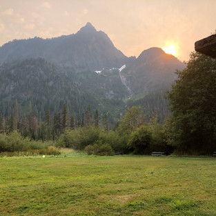
Left Kent just before 10am, Saturday, headed north on I5 to Arlington, then east to Darrington, and south on Mountain Loop hwy. Took a right at Clear creek road and up into the woods we went... One of my favorite areas to get away. After a short stop at Frog lake, the road up to the bridge is only about 7 miles, but it did get rough in several places. Just past the bridge is where I usually set camp. After a few hours at the creek/bridge, we headed back down to the Mtn loop and turned south. The loop hwy is open now, but lots of rough patches and big pot holes. Well worth the rattling of teeth, we got a few good shots here and there and stopped at Big Four for a few minutes to take a few more.
top of page
ADVENTURE TRAVEL ENTHUSIASTS DEDICATED TO OVERLAND EXPLORATION
bottom of page


It's all FS road, so camp sites are rough back woods no amenities. The turn off for the bridge is roughly 7 miles in if I remember. It's the only real left turn from the main fs road once you pass the lake. There's a little spot just up from the bridge further on, and a larger space farther up still. Then even further is a nice view area, but no camp spots.
Great photos from your trip! I think I will try to retrace your steps, looks beautiful. You mentioned camping, are they campsites or is it woodland camping?